Drone journalists just got some very good news. The FAA says that this year it will begin offering “instant authorization” for drone flights in controlled airspace. It will start what is called Low Altitude Authorization and Notification Capability, or LAANC, in select cities. By the end of the year, 50 cities will be included.
In an article for Forbes, Pepperdine professor Gregory McNeal, a leading voice in drone technology, said that the first big city airports that will provide instant approval will be Cincinnati, Phoenix, and Miami. A few mid-sized Class C airports, including Lincoln, Nebraska and San Jose, California, will also be in the first round trials. Most of the first instant approval sites will be the smallest Class E airports, including Norfolk (Virginia) Regional Airport, Mankato (Minnesota) Regional Airport and Mason City (Iowa) Municipal Airport
This is great news for journalists who are covering a story within five miles of a big airport and can’t fly a drone without a waiver. Even if government paperwork flows your way right now, it could take 90 days to get a waiver.
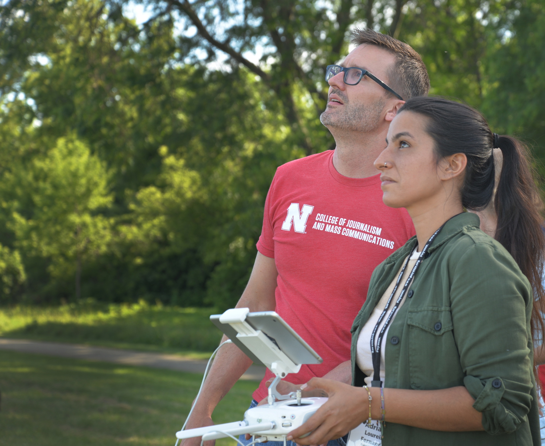
Matt Waite, Drone Journalism Lab founder, teaching at the Poynter Drone School in Madison, Wisconsin.
The new system is part of a concept called unmanned traffic management that drone visionaries have pushed for years. The UTM process will factor in how much the airspace is controlled, it will factor in weather, local restrictions and public safety (for example, are there lots of people living or gathering nearby?)
Right now, every decision about whether the FAA will grant a waiver to its set flight rules has to be done manually by a human who reads the request and makes a ruling. But with millions of drones in private hands, the requests are going to become so large the FAA will never be able to handle it all manually. Last November, tech companies including AirMap, Amazon, ANRA Technologies, Simulyze, Skycart and Transtrex, demonstrated how their UTM programs would work. Airmap’s website shows how the system would work from filing a waiver to getting the FAA’s response.
Matt Waite, the founder of the Drone Journalism Lab at the University of Nebraska, also leads the Drone Journalism Schools that Poynter organizes with our partners NPPA, DJI and Google News Lab.
“The single largest impediment to journalists using drones for breaking news is access to airspace,” he said. “When it can take months to get approval from the FAA, that just doesn’t work for most news uses. This is a giant leap toward drones being a common part of your local news.”
One of the systems that pilots will use is AirMap. The company says, “Drone operators will enter the details of their flight with just a few taps, and in areas where flights are pre-approved, receive instant authorization to fly.” Systems like AirMap will allow you to select the area you want to fly on the app, and it will give you a quick idea of whether there are restrictions on the airspace. If there is a restriction but it is possible to fly with a waiver, the app prompts the pilot to ask for permission. You should get a response right away, not in 90 days as is currently the case.
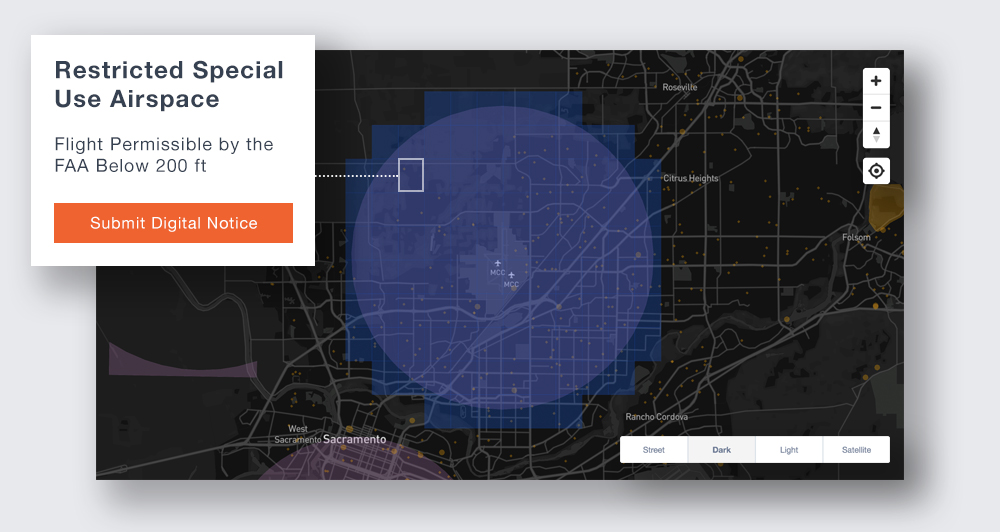
From https://www.airmap.com/faa-uas-facility-maps-laanc/
The backbone of this whole system is the FAA’s new unmanned aircraft system facility maps that the government is rolling out. Those maps will give pilots a pretty good idea of whether they are likely to get waiver approval before they bother sending in a request. (Note: if you click on the above link it takes a few seconds for the maps to populate the page. The FAA is adding new data constantly and the map is supposed to be complete by October 31, 2017.) If you see on the map that the ceiling where you want to fly is zero, then there is no reason to ask for a waiver.
“To be clear, this isn’t going to magically solve all of the issues around using drones for journalism,” Waite said. “Drone pilots will still have to avoid flying over people, we’ll still have conflicts between journalists and law enforcement officers about when and where drone cameras can be used, and we’ll still have ethical decisions to make. But this starts to remove a significant obstacle.”
Mickey Osterreicher, legal counsel for the National Press Photographers Association, also teaches in our Drone School. He told Poynter that “as technology advances at an exponential rate, we often see the gap between regulations and implementation getting wider. This announcement is a perfect example of how technology can also be used to bridge that divide by automating the previously time-consuming manual process of approving such authorizations to fly in controlled airspace. This is but one of many hoped-for technological solutions that will make the use of drones for newsgathering as commonplace and easy to comply with as doing an internet search on one’s computer.”
AirMap says on its website that journalists are just some of the pilots who will benefit from faster airspace approval.
Without at least 90-days’ notice, most jobs never get off the ground. That’s a big deal. The top drone-friendly industries include real estate, construction, logistics, infrastructure, and public safety, all of which exist to serve populated areas. Not surprisingly, substantial portions of these areas exist in controlled airspace near the airports that serve them. Without a smarter airspace authorization solution in place, the United States economy is missing out the $127.3 billion global market value of the commercial drone sector.
McNeal says these airports will put the instant approval system in place first. The list goes from the largest airports (Class B) to smaller regional airports (Class E):
| Class/ | Code/ | Airport |
| B | CVG | Cincinnati/Northern Kentucky International Airport |
| B | MIA | Miami International Airport |
| B | PHX | Phoenix Sky Harbor International Airport |
| C | ANC | Anchorage International Airport |
| C | GRB | Green Bay- Austin Straubel Int’l Airport |
| C | LNK | Lincoln Airport |
| C | RNO | Reno- Tahoe International Airport |
| C | SJC | San Jose International Airport |
| D | LHD | Lake Hood Seaplane Base |
| D | MRI | Merrill Field |
| E | ABR | Aberdeen Regional Airport |
| E | AMW | Ames Municipal Airport |
| E | ATY | Watertown Regional Airport |
| E | AXN | Alexandria Municipal Airport |
| E | BJI | Bemìdji Regional Airport |
| E | BKX | Brookings Regional Airport |
| E | BRD | Brainerd Lakes Regional Airport |
| E | CIU | Chippewa County International Airport |
| E | CMX | Houghton County Memorial Airport |
| E | DIK | Dickinson Airport |
| E | DVL | Devils Lake Regional Airport |
| E | EAR | Kearney Regional Airport |
| E | ELO | Ely Municipal Airport |
| E | ESC | Delta County Airport |
| E | FFM | Fergus Falls Municipal Airport |
| E | FOD | Fort Dodge Regional Airport |
| E | FRM | Fairmont Municipal Airport |
| E | HIB | Range Regional Airport |
| E | HON | Huron Regional Airport |
| E | HSI | Hastings Municipal Airport |
| E | IKV | Ankeny Regional Airport |
| E | IMT | Ford Airport |
| E | INL | Falls International Airport |
| E | IWD | Gogebic- Iron County Airport |
| E | JMS | Jamestown Regional Airport |
| E | MCW | Mason City Municipal Airport |
| E | MHE | Mitchell Municipal Airport |
| E | MKT | Mankato Regional Airport |
| E | OFK | Norfolk Regional Airport |
| E | OLU | Columbus Airport |
| E | OSC | Wurtsmith Air Force Base |
| E | OTG | Worthington Municipal Airport |
| E | PIR | Pierre Regional Airport |
| E | PLN | Pellston Regional Airport |
| E | RHI | Rhinelander- Oneida County Airport |
| E | RWF | Redwood Falls Municipal |
| E | SLB | Storm Lake Airport |
| E | SPW | Spencer Municipal Airport |
| E | TVF | Thief River Falls Regional Airport |
| E | YKN | Chan Gurney Airport |